 |
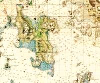
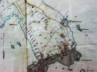
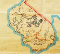
Lauttasaari (Drumsiö Landet) in a Swedish 1780 coastal map
(source: Military Archives, Stockholm; courtesy of the Finnish
Maritime Administration (copyright)) |
 |
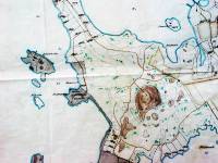
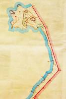
A Swedish 1803 coastal map
(source: Military Archives, Stockholm) |
 |
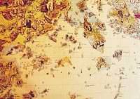
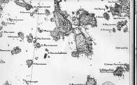
Maps of Finnish administrative parishes, 1850
(source: National Archives, Helsinki) |
 |
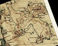
Lauttasaari (Drumsö) in a 1871 map.
(source: Military Archives, Helsinki)
|
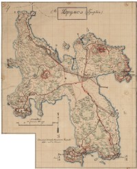 |
Lauttasaari (О.Друмс-э) in a Russian military topographical map of 1893. The map, with other topics, are presented on the pages of the National Archives of Finland. Russian military documents form a separate collection of 18,000 documents occupying 338 meters of shelf space. In addition to this, the National Board of Antiques has 7,500 maps and drawings in their archives. All this material was left in the country when Russian troops withdrew from Finland in 1917-1918.
|
 |
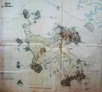
Lauttasaari (О.Друмсэ) in a Russian military topographical map of 1902. Дачи = villas.
(source: National Library, Helsinki)
|
 |
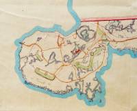
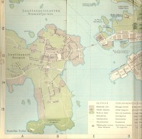
Karta öfver Drumsö of 1911.
(source: Helsinki City Archives). |
 |
Detail map of the NE part of the island.
(source: Helsinki City Archives) |
 |
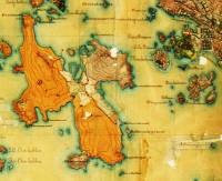
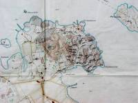
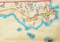
Detail map of the southern part of the island. Shaded areas: restricted areas containing Russian cannon batteries.
(source: Helsinki City Archives) |
 |
Detail map of the central part of the island. Shaded areas: restricted areas containing Russian cannon batteries.
(source: Helsinki City Archives)
|
 |
An extensive exchange of land property between the State and the city of Helsinki took place in 1927. The former Russian military areas in Lauttasaari were a small part of this. Detail map of 1928 of the western end of the southern strip of the transferred territory (despite of the city ownership Lauttasaari, however, was then administratively yet not part of Helsinki). Green colouring shows the cannon bulwarks. Photos.
(source: Helsinki City Archives) |
 |
Detail map of the eastern part of this area.
(source: Helsinki City Archives) |
 |
Detail map of the SW tip of the island.
(source: Helsinki City Archives) |
 |
Detail map of the western restricted area.
(source: Helsinki City Archives) |
 |
A map of 1943.
(source: The Helsinki map of the Frenckell Printing Press. ) |


